9.0 Richter magnitude
Special page
Pagina speciale sul
terremoto di Sumatra
9.0 magnitudo Richter
by Mauro Mariotti
29th December 2004
|
9.0 Richter magnitude Special page Pagina speciale sul
by Mauro Mariotti |
29th December 2004 |
|
|
The page contains large pictures and animation, it may take some minutes for loading depending on your connection, be patient....
http://earthquake.usgs.gov/eqinthenews/2004/usslav/
http://whyfiles.org/068tsunami/
http://www.hewsweb.org/seismic/
(fotografie dei rispettivi autori)

Theoretical Seismic Travel Time

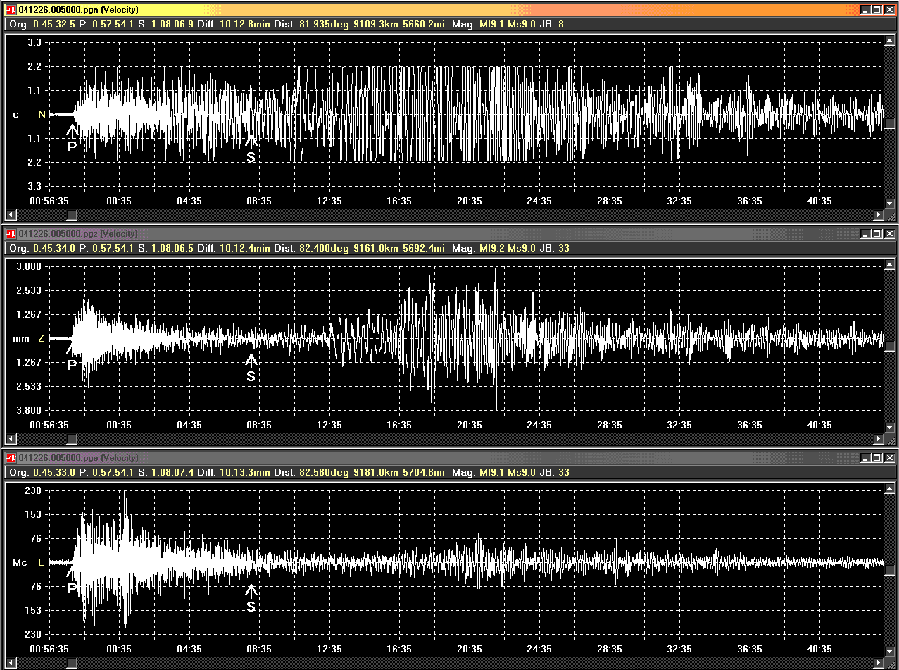
Real Time Drum of Perugia Seismic Station North-South Axis.

Recorded Seismograms from the Perugia Seismic Station 3 axis
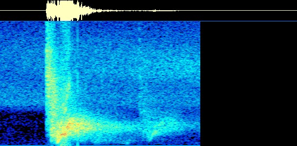
Earthquake Spectrogram
Earthquake waves audification with 400x speed-up (Phonoseismology) wav file 83kbytes.
| Italian
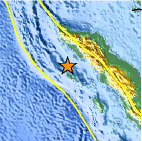
L'evento sismico Alle ore 00.59 del 26 dicembre 2004 è stato registrato un evento sismico catastrofico, localizzato nel Golfo del Bengala, tra Sumatra, Indonesia, Thailandia, India, Sri Lanka. La magnitudo definitiva è di MW 9.0 Richter, in accordo con i maggiori Enti scientifici internazionali. L'epicentro è a 03.30N / 95.78E, ovvero a largo delle coste
nord occidentali di Sumatra.
La localizzazione ipocentrale marina ha purtroppo causato un terribile tsunami (maremoto) che in poco tempo ha investito tutte le coste che si affacciano sul Golfo del Bengala, causando danni vastissimi e purtroppo decine di migliaia di vittime. E' stato avvertito in maniera considerevole in Sri Lanka, Thailandia, Maldive, Cocos Island, Sumatra, Bangladesh, India, Malaysia, Myanmar, Singapore.
Cos'è una Tsunami? La parola Tsunami è un termine giapponese che significa "onda
di porto".
|
English
At 00.59am of 26th December 2004 a catasstrofic seismic event has been recorded located in the Bengala gulf between Sumatra, Indonesia, Thailand, India and SriLanka. The magnitude of the earthquake based on the Richter scale is 9.0, according to the majority of the international scientific institutions. The epicenter has been located at 03.30 N / 95.78E on the sea at west of Sumatra island. The sea hypocentral location caused a terrible tsunami wave that in
the successive hours impacted on all the coasts of the Bengala's Gulf causing
large damages and casualties. It has been felt in relevant way in Sri Lanka,
Thailandia, Maldive, Cocos Island, Sumatra, Bangladesh, India, Malaysia,
Myanmar, Singapore.
What is a Tsunami? The word Tsunami is a Japanese word meaning "harbor wave". Vertical movement of the ocean floor raise or lower the water above
it, causing waves that move outward. Almost undetectable in the deep ocean,
tsunamis rise to a mighty crest as the ocean shallows.
|
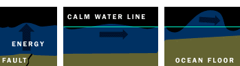
1) The earthquake release energy in the ground and in the water over
the epicenter
2) The waves are relatively small in open sea
3) While the tsunami reach the beach the waves become bigger


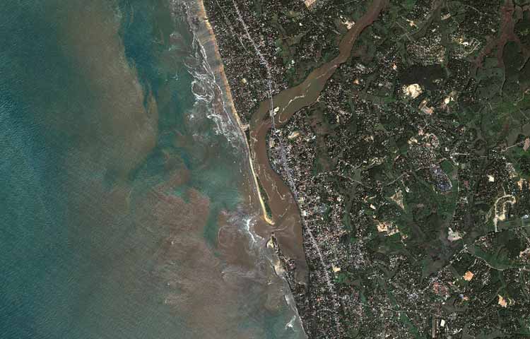
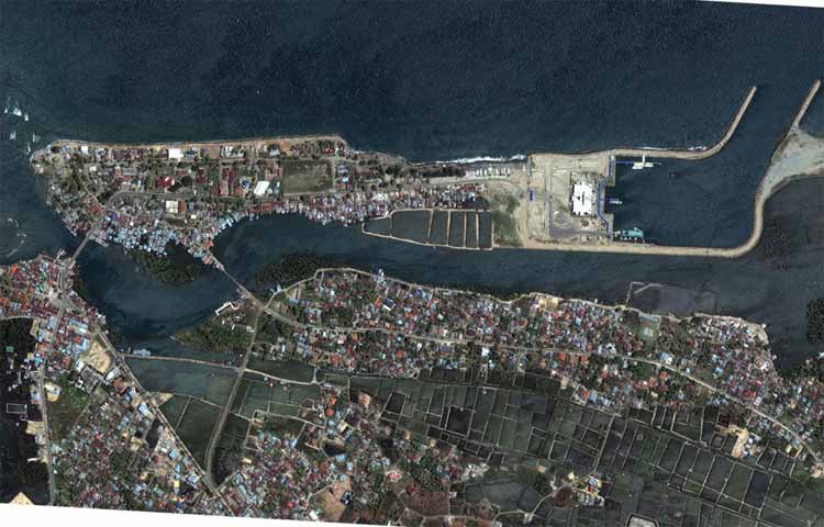
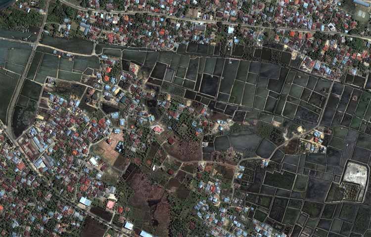
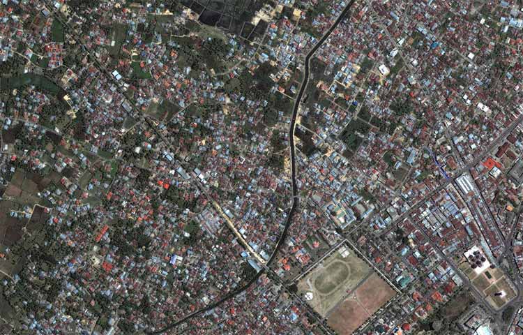
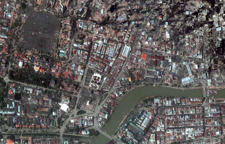
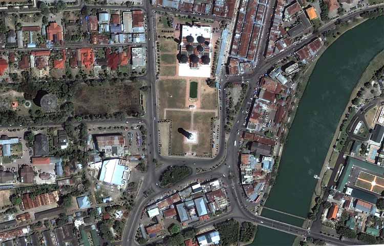
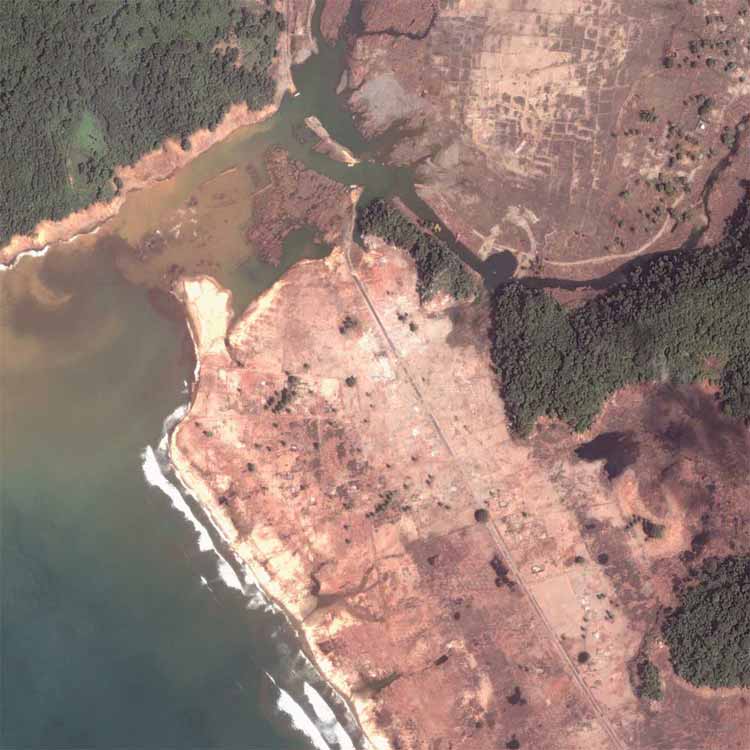
Before the tsunami

Right after the tsunami

before

after

before
after


after

before

after


after
before

after


after

before

after
Map

![]()
Nedstat counter